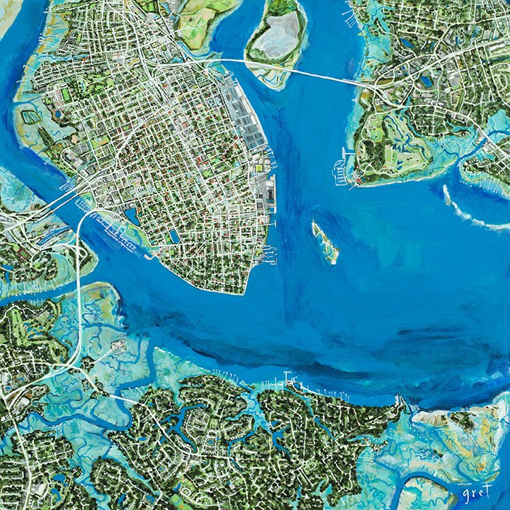
Charleston peninsula / Ashley River bridge area / James Island / Mt Pleasant Map Print
Charleston peninsula / Ashley River bridge area / James Island / Mt Pleasant Map Print
from $75.00
This is a print of an original 30”x 30” acrylic painting that is one part of a triptych showing the Charleston Harbor and surrounding islands. This portion of the map shows the peninsula/downtown, the Ashley Bridge area in West Ashley, and portions of James Island and the western side of Mt Pleasant, SC.
Locally printed on archival matte paper. Background extends to edge. Each print will have a hand-painted signature by the artist. (Frame not included.)
Ships out of Charleston, SC - larger sizes may be printed to order, adding a few days lead time.
*Additional print sizes can be ordered if you’re looking for something specific.
Size:
Quantity:

